This brief yet unforgettable experience will provide you with an insight into the life in Bhutan traveling through Thimphu the capital, Punakha the old capital and Paro known for the Tiger’s Nest Temple. Highlights in this tour include the Tashichho Dzong (the fortress of the Glorious Religion), the Punakha Dzong (the Palace of Great Happiness) and the Tiger’s Nest Temple.
Altitude in Paro: 2,280m
Distance: 55km
Estimated travel time: 1.30 hour
Potential areas for photography
• Rinpung Dzong (Fortress on a Heap of Jewels), National Museum, 7th century Kyichu Temple among several other ancient religious monuments and sites
• The ruins of Drugyal Dzong (currently it’s under construction) and Taktshang (Tiger’s Lair) Monastery, famed for its religious significance and architectural wonder
• Villages, farmhouses, people
Paro Rinpung Dzong (Fortress of The Heap of Jewels) - Rinpung Dzong is an ancient fortress in traditional Bhutanese architecture with a complex of courtyards, temples, administration offices and open space surrounded by towering walls. All the buildings are equipped with huge windows with elaborate wooden carvings of traditional Bhutanese motifs. Paro Dzong is considered one of the finest examples of Bhutanese architecture and it’s one of the top tourist attractions in Bhutan. This impressive dzong is also seen during landing into Paro Airport.
National Museum of Bhutan – Ta Dzong. Originally built as a watchtower in 1649, atop a hill above the Rinpung Dzong, overlooking the whole picturesque Paro valley. Converted into a museum in 1968, its extensive collection includes astonishing antique thangka paintings, weapons and armor, and rich diversity of natural and historic artifacts.
Highest altitude: 3,120m
Distance 4Km (one way hiking)
Driving distance; 1 hours 65Km (Paro to Thimphu)
Potential areas for photography
Best from the bird eye view at early morning and around afternoon best from opposite of monastery.
Taktsang Monastery, or the Tiger’s Nest (highest altitude: 3,120m)- A 8 km hike that will typically take 5-6 hours ascending around 600m to reach the destination. An experience through dense enchanted forests and spectacular mountain scenery along the trail.
A stroll through Paro town.
Altitude in Thimphu: 2,320m
Potential areas for photography
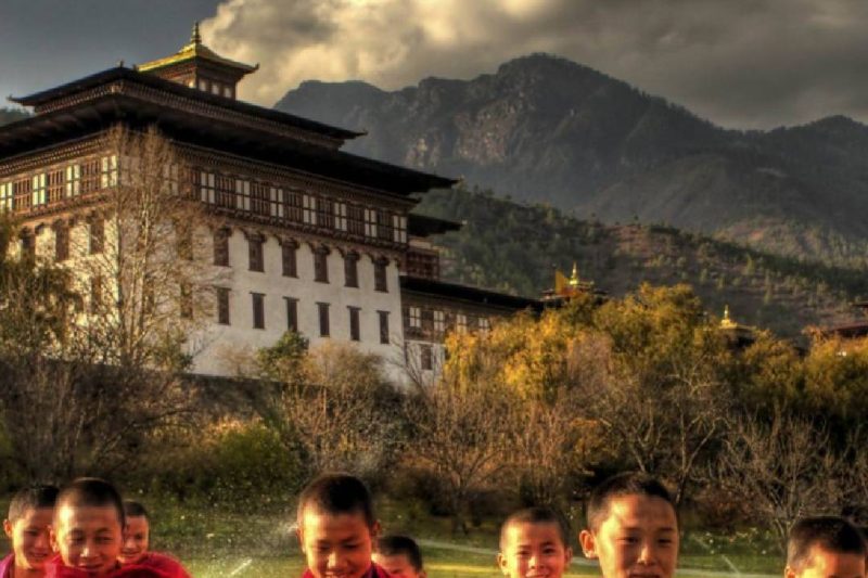
• Tashichhodzong – the magnificent 500-year old seat of Bhutan’s governance and the palace/office of the king.
• Parliament Building – An epitome of modern Bhutanese architecture combined with traditional grandeur.
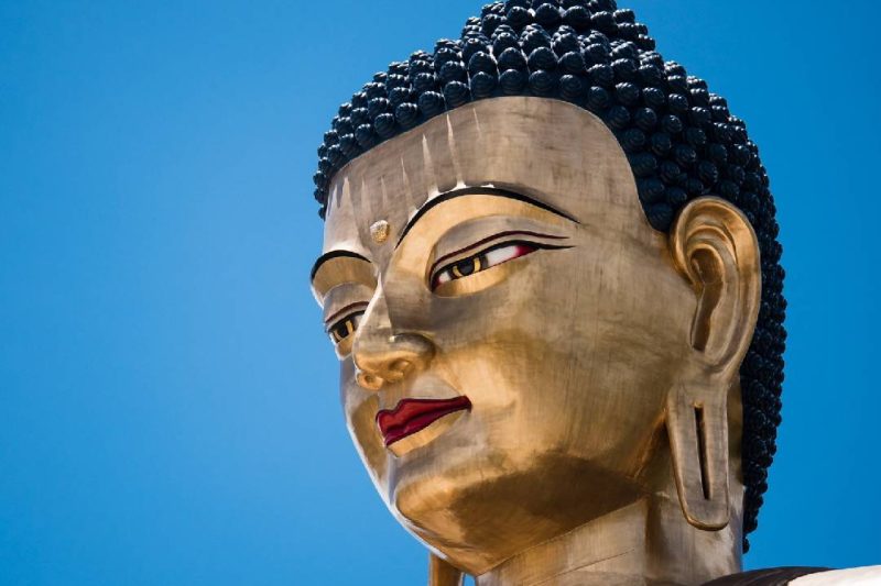
• Buddha – the world’s tallest Buddha built on the breast of a hillock which commands a spectacular view of the capital city.
• Sangaygang– The perfect viewpoint for Thimphu city.
• Memorial Stupa – the most beautiful stupa in Bhutan built in memory of the father of modern Bhutan, king Jigme Dorji Wangchuck
• Vegetable Market – people from various ethnic backgrounds and diverse culture only.• Nation traffic control – Bhutan has only one busy traffic which is control by police man.
• Norzin Lam (street) – The busiest place in the capital
• Textile Museum, Folk Heritage Museum, School of Art and Craft
Altitude in Punakha: 1,300m
Distance: 75 km
Estimated travel time: 3 hours
Potential areas for photography
• Semtokha Dzong, the oldest monastery fortress of Bhutan.
• Dochula, the 3,116 meter pass which provides a breathtaking view of the mighty Himalayas
• Different types of vegetation, from alpine to the sub-tropical, rare birds and flowers
• The Wangdue-Punakha valley, farms and villages,
• Chimi Lhakhang an ancient monasteries (the Temple of Fertility)
• Punakha Dzong, the old capital of Bhutan and Bhutan’s most prized monument
• The under construction of Wangduephodrang Dzong-fortress
• Pho Chhu Suspension Bridge –the longest suspension bridge in Bhutan. Measuring at 160m in length, this is Bhutan’s longest suspension bridge. Spectacular sight of Punakha Dzong and Pho Chhu Valley.
Dochula Pass - The pass is a popular location among tourists as it offers a stunning 360 degree panoramic view of the Himalayan mountain range. The view is especially scenic on clear, winter days with snowcapped mountains forming a majestic backdrop to the tranquility of the 108 chortens gracing the mountain pass.
Chimi Lhakhang- Hike to the Temple of Fertility (altitude: 1,500m). An enjoyable hike, taking about 30 minutes through the rice and mustard fields and the uniquely decorated houses of Lobasa Village.
Punakha Dzong (Palace of Great Happiness). Built-in 1637, it is said to be the most spectacular dzong in Bhutan. Punakha Dzong was built at the confluence of two major rivers in Bhutan, the Pho Chhu and Mo Chhu, which converge in this valley.
In addition to its structural beauty, until the mid-1950s, it still served as Bhutan’s capital and the seat of the government. All of Bhutan’s kings have been crowned here, and it has witnessed the memorable wedding of the King of Bhutan, Jigme Khesar Namgyel Wangchuck to Jetsun Pema in 2011.
Distance: 125 km
Estimated travel time: 2.30 hours
Potential areas for photography
• Rare birds the birds of Heavenly (including the exotic black-necked crane) and animals, and beautiful alpine flowers.
• Pelela pass (3,390 meters), the Black Mountain range, hamlets along the way.
• Lawa la pass (3050 meters), yaks during months of January, February, March and September, October, November, December
• Views of Gangtay –Phubjikha valley
A pleasant hike through paddy fields and pine trees to Khamsum Yuelley Namgyal Chorten.
•Gangtay monastery –one of the olden structure in country, Gangtey Goemba or ‘Gangtey monastery’- The only Nyingmapa monastery in this region, sitting on the crest of a hill on top of Gangtey valley. The monastery was built in 1613 following the prophecy of Pema Lingpa – the famous 15th-century treasure finder.
Altitude in Trongsa: 800 to 4800 meters
Estimated travel time: 2.00 hours
Potential areas for photography
• 18th century stupa at Chendebji
• The Watch Tower of Trongsa
• Trongsa town
• Views of Mangde valley
• Views of Trongsa Dzong – the monastery fortress which is one of the biggest in Bhutan and traditionally the power centre of central-east Bhutan.
Distance: 98 km
Estimated travel time: 2.30 hours
Yotongla pass (3,400 meters)
• Bumthang valley, one of the most beautiful in Bhutan, filled with old palaces, historical and religious monuments.
• Jakar Dzong (Castle of the White Bird)
• Wangdicholing Palace and Domkhar Palace
• Airstrip, villages, nature trails, towns, etc.
Distance: 120 km
Estimated travel time: 2.30 hours
Note: Day excursion
• The legendary Mebartsho (Burning Lake)
• The famous Kurjey Temple and 7th century Jambay Lhakhang (temple)
• Tamzhing Monastery,
Distance 140 KM
Altitude in monger: meters
Estimated travel time: 6.00 hours
Potential areas for photography
• Thrumshingla National Park and the Thrumshingla Pass (3,780 meters)
• Sengor-Yongkala-Lingmithang area, which is known as the Birding Capital of the World. Has the world’s highest density of birds, including some of the most rare.
• Ruins of Zhongar Fortress
• Kurichu Hydroelectric Dam and power house
• Lingmethang and Mongar towns
Distance 90 KM
Altitude in tashigang: meters
Estimated travel time: 4.00 hours
Potential areas for photography
• Korila Pass and the surrounding views of the landscape of eastern Bhutan
• Yadi zig, and shots of the valley carved by Dangmechu, the biggest river of Bhutan
• Gomphu Kora, a great site of pilgrimage for Buddhists
• Trashigang Dzong, historically the powerhouse of the regional ruler
• Trashigang town
Distance 70 KM
Altitude in tashigang: meters
Estimated travel time: 4.00 hours
• North Trashigang, the most populated area of Bhutan and the centre of local culture, customs, traditions, lifestyle
• Brahmi, a tribal community in Chaling and Phongmey
• Merak, area of semi-nomadic tribe called Brokpa, and nearby landscapes
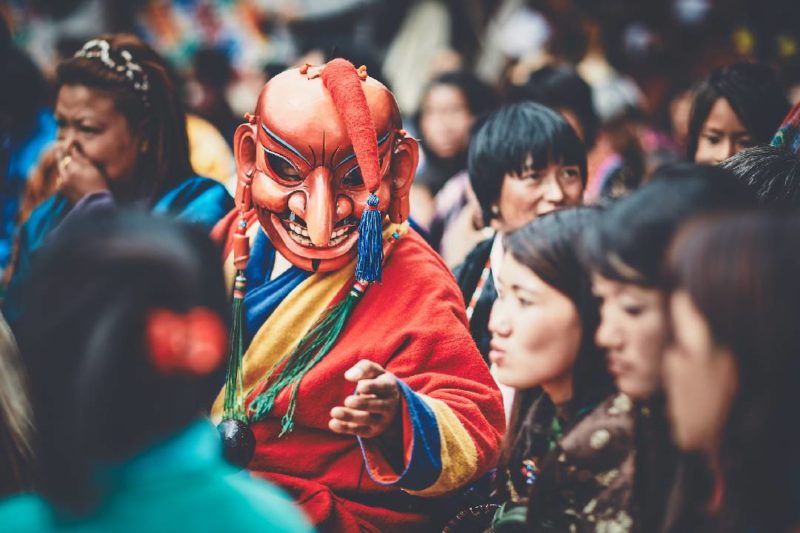
• Folk festival, dance and music in the region
Domestic flight from Yanphula Tashigang to Paro.
Relax and Stole around Paro town


